Map Analysis Details

Project Information
- Category: Flood Analysis
- Client: GeoTourism UTM
- Project Date: 17 February, 2025
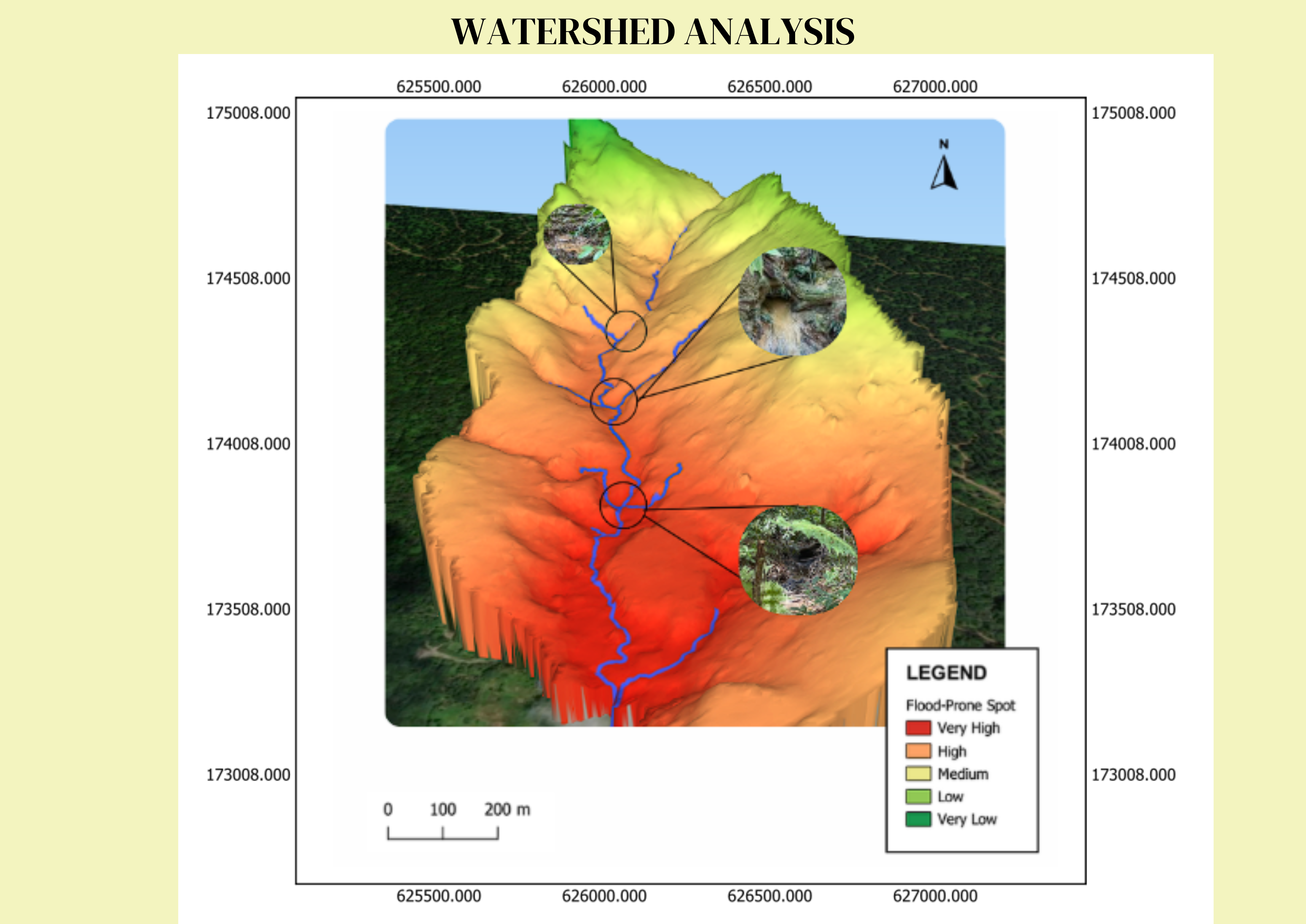
Flood-Prone Area Identification
This 3D terrain model highlights flood-prone zones based on elevation and water flow patterns. The color gradient represents different risk levels, ranging from very low (green) to very high (red). Field images of the identified flood-prone spots provide real-world validation of the analysis.
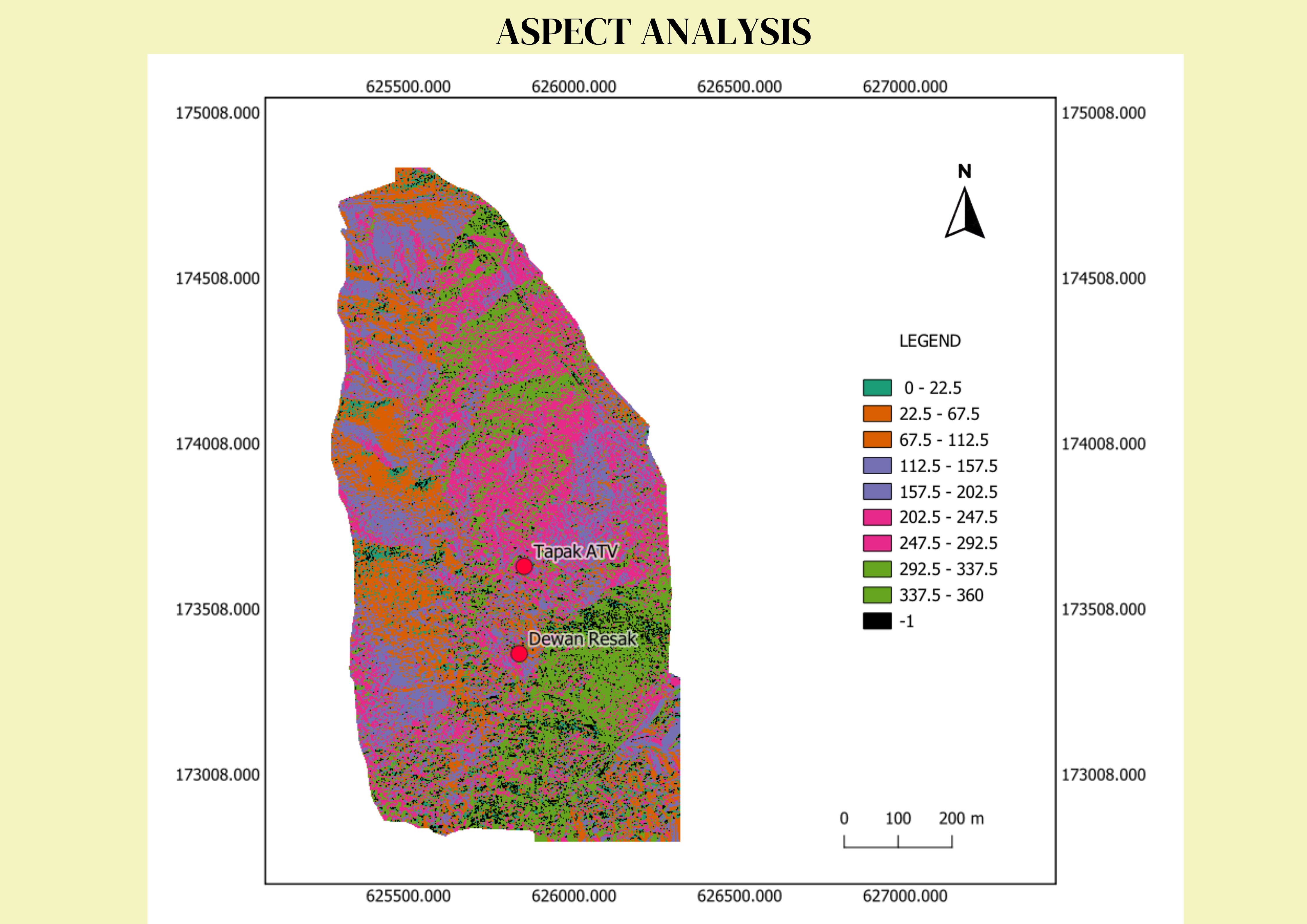
Aspect Analysis
This aspect analysis map classifies terrain orientation using different colors, representing aspect values from 0° to 360°. Aspect indicates the direction a slope faces, influencing factors like sunlight exposure, vegetation growth, and erosion patterns. Areas facing north (0°) may receive less sunlight, while south-facing slopes (180°) tend to be warmer and drier. The marked locations, Tapak ATV and Dewan Resak, are situated in areas with varying aspects, which can impact site suitability.
Slope Analysis
This slope analysis map categorizes terrain into six slope ranges, from gentle (0-15°) to extremely steep (≥90°), using a color gradient. Gentle slopes (green) are suitable for development, while steeper slopes (red) indicate erosion-prone or unstable areas. Two marked locations, Tapak ATV and Dewan Resak, are in relatively stable regions. This analysis is essential for urban planning, flood risk assessment, and environmental management.
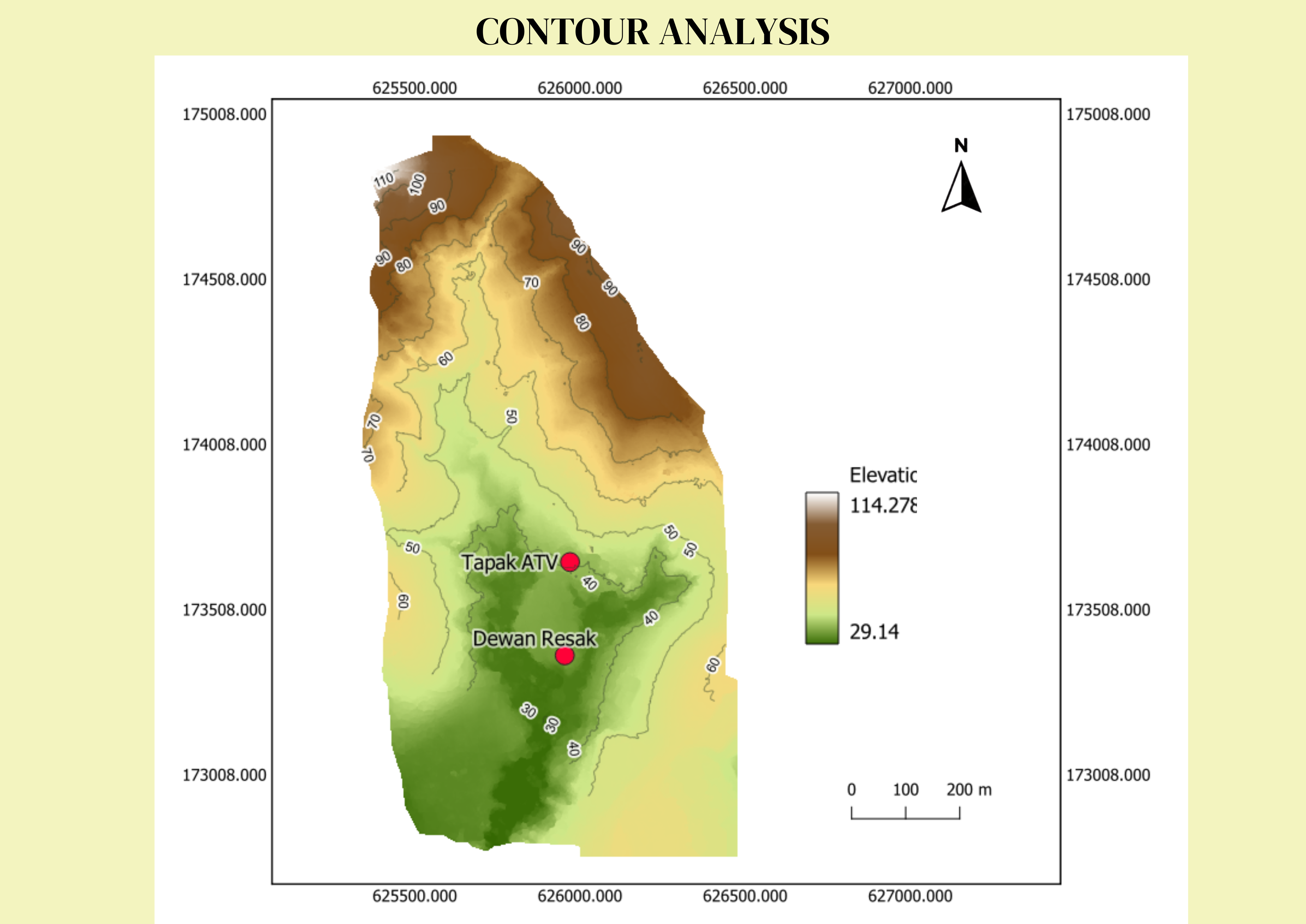
Contour Analysis
This contour analysis map represents elevation variations using contour lines and a color gradient. Lighter shades indicate lower elevations, while darker shades represent higher terrain. Contour lines connect points of equal elevation, with closely spaced lines indicating steep slopes and widely spaced lines representing gentle slopes. The locations Tapak ATV and Dewan Resak are situated in lower elevation areas with gradual slopes.
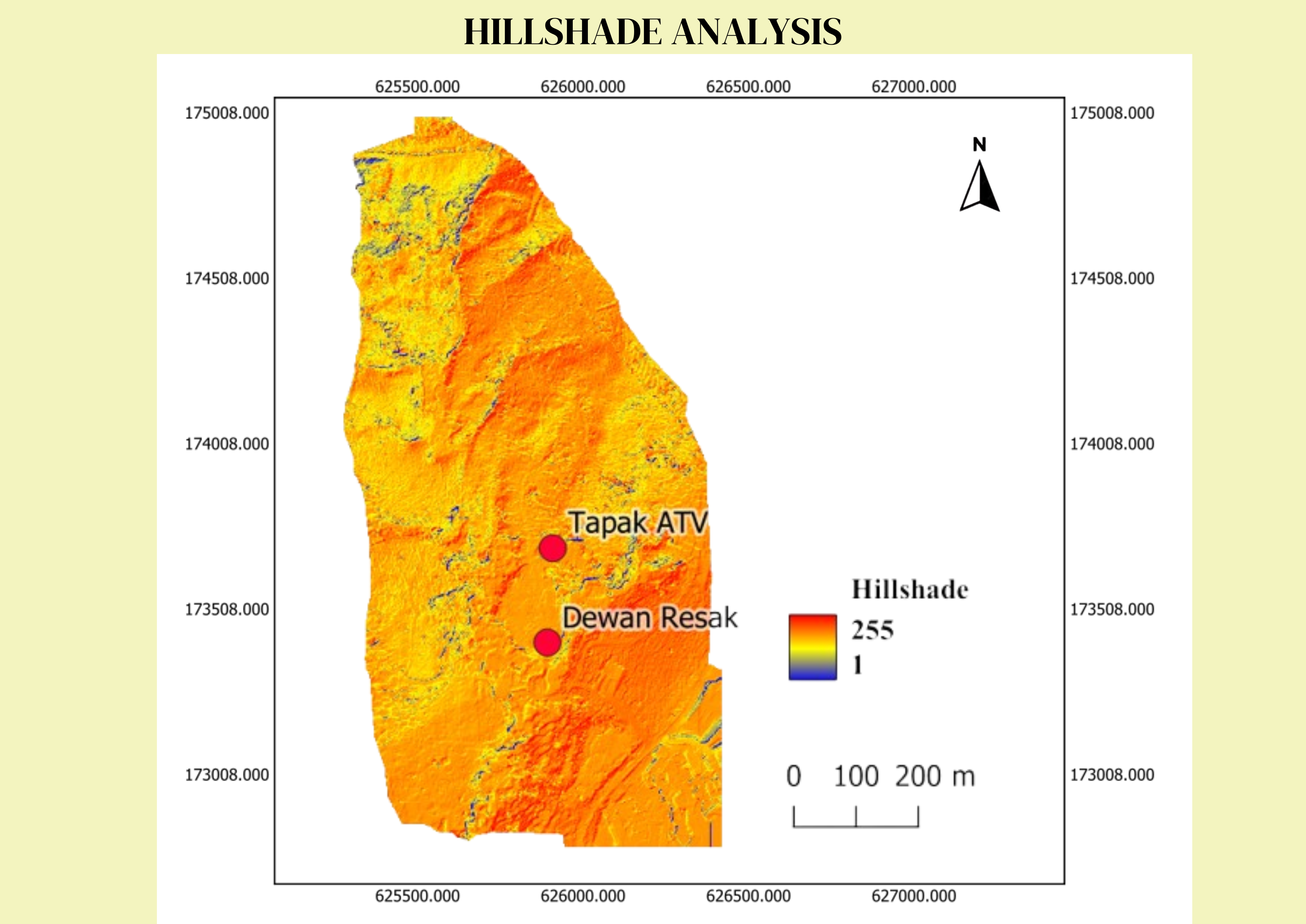
Hillshade Analysis
This hillshade analysis map visualizes terrain relief by simulating light and shadow effects based on elevation and slope. Brighter areas (high values) indicate well-lit slopes facing the light source, while darker areas (low values) represent shadowed or steep regions. The locations Tapak ATV and Dewan Resak are positioned in relatively illuminated zones, suggesting moderate terrain variations.